วันพฤหัสบดีที่ 3 กรกฎาคม พ.ศ. 2557

places which are forbidden to display on Google Maps


places which are forbidden

to display on Google Maps

Places which are forbidden 
to display on Google Maps 
พิกัดที่กูเกิลเอิร์ธแสดงไม่ได้ 

Mapping service Google Maps displays the entire Earth. Well, almost all. Some places are just 
not available for viewing or specially painted over or washed out.

ตำแน่งความลับของหลายๆ ประเทศในโลกนี้  เราไม่อาจเรียกใช้บริการของ Google Earth ได้
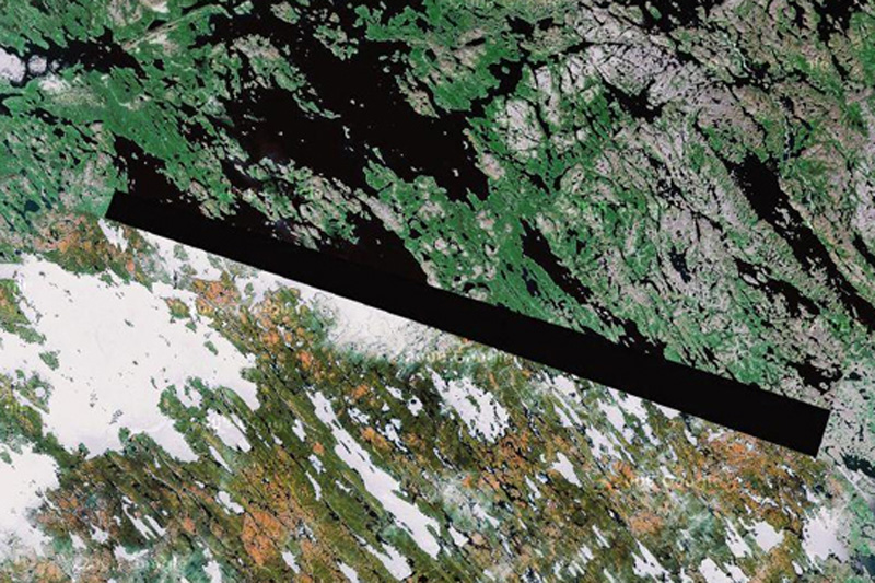
Google Maps January 23 seats, which are prohibited for display on Google Maps..

1. Baker Lake, the territory of the Inuit in northern CanadaA man who identified himself as
"Dr. Boylan" believes shaded area in this image and in some other locations, hiding extraterrestrial beacons aliens.
ทะเลสาปเบเกอร์  ตอนเหนือของประเทศแคนาดา  ชายที่เรียกตัวเองว่า "Dr. Boylan" เชื่อว่า เป็นที่หลบซ่อนของมนุษย์ต่างดาว
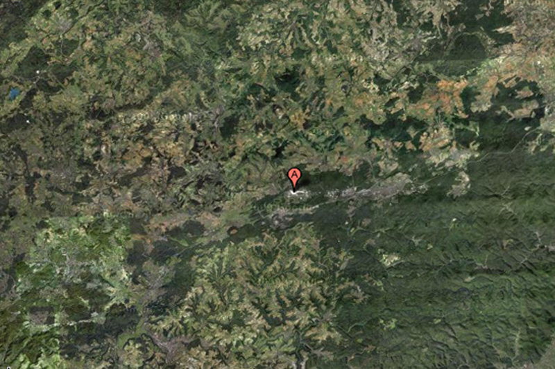
Google Maps on February 23 places that are forbidden to display on Google Maps


  2. Air base Ramstein, GermanyThis NATO air base is the starting point for the forces of
"Operation Iraqi Freedom", and for this reason can certainly be a target for terrorist attacks. This may explain why the object is partially carved out of Google Maps.
 ฐานทัพอากาศแรมสไตน์ ประเทศเยอรมนี
 เป็นฐานทัพของนาโต (พันธมิตรทางทหาร ประกอบด้วย
สหรัฐอเมริกา และกลุ่มประเทศยุโรปตะวันตก)
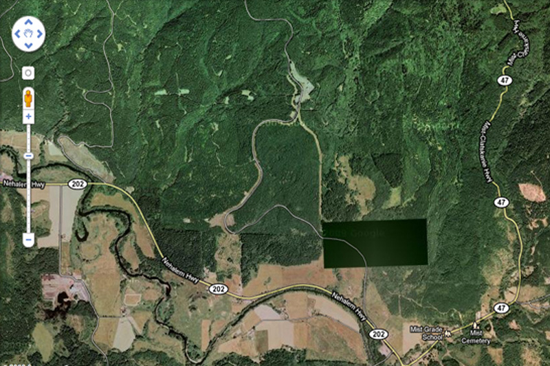
Google Maps on March 23 places that are forbidden to display on Google Maps
3. Pacific Northwest, USAWhat exactly we do not see in this photo? This place is not
 far from the border of the states of Washington and Oregon Enthusiasts have personally inspected the place and foundnothing remarkable but ominous-looking fence and no markedentrance.
ชายฝั่งมหาสมุทรแปซิฟิกตะวันตกเฉียงเหนือ สหรัฐอเมริกาเมื่อไปดูสถานที่จริงก็ไม่มีอะไรผิดสังเกต ทุกอย่างปกติ(แต่จริงๆ คงมีอะไรซ่อนอยู่)
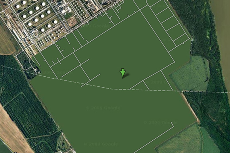
Google Maps April 23 seats, which are prohibited for display on Google Maps

4. Oil refinery Shazalombatta, HungaryThis is one of the most bizarre specimens of censorship in 
Google Maps - this place is just drawn in green. Area of ​​theplant is removed, the building erased, and all you can see - this is a common herb.
 โรงกลั่นน้ำมัน ประเทศฮังการี ดูๆ ก็ไม่มีอะไรแปลก แต่ดูด้วยกูเกิลเอิ์ธไม่ได้
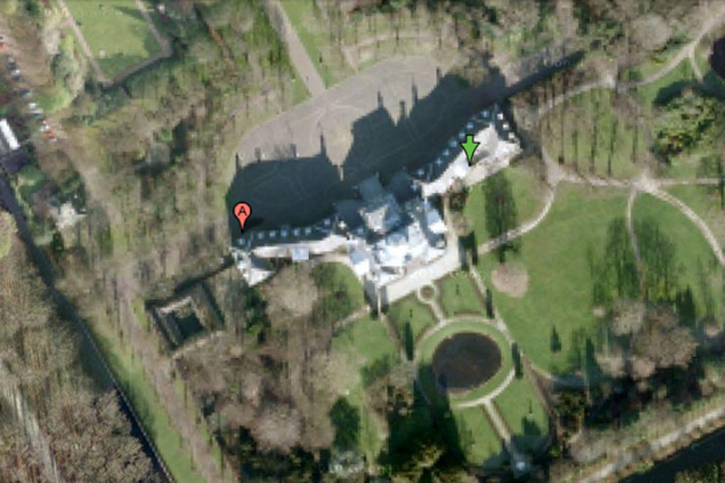
Google Maps on May 23 seats, which are prohibited for display on Google Maps
5. Palace Hyuis Ten, The NetherlandsIt is difficult to imagine that the Dutch royal family can be a
 prime target for mad terrorists, but the royal palace Hyuis Ten severely eroded on Google Maps when viewed from any angle. (However, the surrounding area and trees at close increase seen in crystal clarity.)
พระราชวังของเนเธอร์แลนด์ เกรงว่า อาจจะเป็นเป้าโจมตีของคนที่ไม่ชอบราชวงศ์ได้  
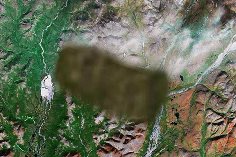
Google Maps June 23 seats, which are prohibited for display on Google Maps
6. Unknown zone, RussiaNo one knows what lies in the region. One view - that there is a
 "radar or missile interception system," and some say that apicture is inserted into the surrounding area from another regionof Russia.
ไม่ทราบตำแหน่ง  ประเทศรัสเซียเป็นจุดที่ตั้งระบบป้องกันภัยทางยุทธศาสตร์ ของประเทศมหาอำนาจทางทหาร อย่างสหพันธรัฐรัสเซีย
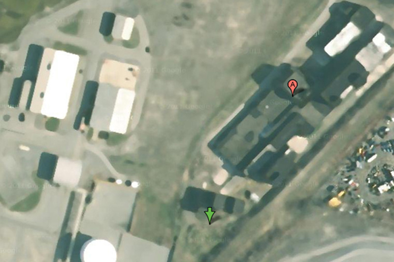
Google Maps on July 23 seats, which are prohibited for display on Google Maps
7. Oil Corporation Mobil, Buffalo, New York, USASome have criticized the company for Mobil of Buffalo blur
 pictures of her business, saying that oil companies are not much of interest to terrorists. On the other hand, we do not know what they think the terrorists themselves.
บริษัทน้ำมันยักษ์ใหญ่ โมบิลออยล์  ณ เมืองบัฟฟาโล รัฐนิวยอร์กคงกลัวว่า จะเป็นเป้าหมายของผู้ก่อการร้าย
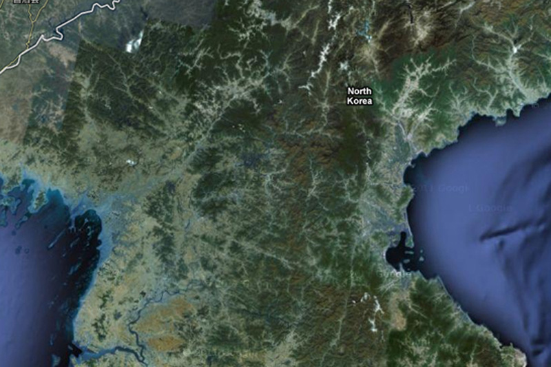
Google Maps August 23 places that are forbidden to display on Google Maps
8. North KoreaAbout the country of the alleged "Axis of Evil", heard
 everything, but very few people have ever visited her. You will not see it on GoogleMaps,since the wholecountry exists in images but without road markers,
 street names or any other identifying details.
เกาหลีเหนือ ประเทศที่ถูกกล่าวหาว่า เป็นแกนนำแห่งความชั่วร้าย ก็คงต้องระวังตัวเองไม่ให้เป็นเป้าโจมตีได้
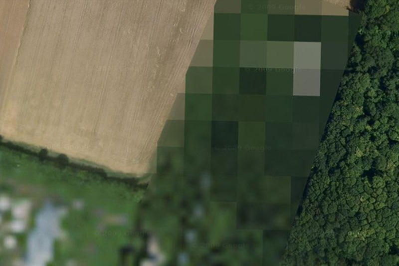
Google Maps September 23 places that are forbidden to display on Google Maps
9. The airbase at Reims, FranceThe reasons for this air base locked in Google Maps, is unknown.
ฐานทัพอากาศ  ประเทศฝรั่งเศส
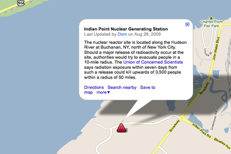
Google Maps October 23 seats, which are forbidden to display on Google Maps
10. Indian Point Power Station, New York, USAMany members of the government of the United States called
 for a halt Indian Point power plant. In addition to environmentalconcerns, according to experts in the field of energy, the power is not strong enough to withstand an earthquake, such as the one recently destroyed Japan.
โรงงานผลิตไฟฟ้า  รัฐนิวยอร์ก  คงกลัวการก่อการร้ายนั่นแหละ   
Google Maps 11 23 places that are forbidden to display on Google Maps
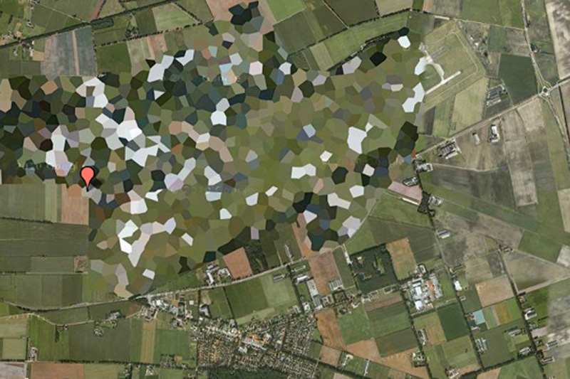
11. Volkel Air Base, NetherlandsPretty funny to see how rough blurred this air base in satellite
 images, however, WikiLeaks published diplomatic correspondence, which confirms the presence of nuclear weapons on the territory of the base.
ฐานทัพอากาศ  ประเทศเนเธอร์แยนด์
Google Maps December 23 places that are forbidden to display on Google Maps
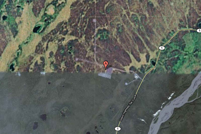
12. HAARP, Hakon, Alaska, USA
HAARP (High-Frequency Program Northern Lights) - this is
 one of the most controversial operations, which is currentlybeing conducted in the United States. Hakon, space research, and ongoing experiments with the ionosphere there, someconspiracy theorists are honored to be the cause of anything
 - from floods to earthquakes, but very little evidence of this.
ศูนย์ศึกษาวิจัยภัยธรรมชาติ  รัฐอลาสกา (อยู่ในเขตขั้วโลกเหนือ)  สหรัฐอเมริกา

Google Maps 13, 23 beds, which are forbidden to display on Google Maps
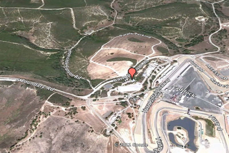
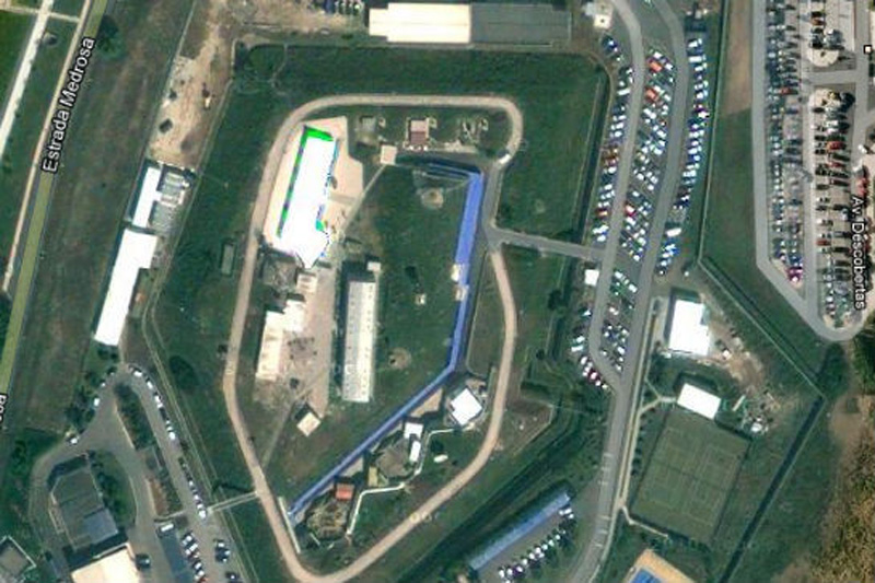
13. Mazda Raceway Laguna Seca, Salinas, California, United StatesThis is one of the most bizarre examples of censorship
 in Google Maps: Raceway Laguna Seca in Salinas, California.The strange thing in this is the fact: it is obviously harmless
 racing track.สนามแข่งรถมาสดา  มลรัฐแคลิฟอร์เนีย  สหรัฐอเมริกา
Google Maps 14, 23 beds, which are forbidden to display on Google Maps
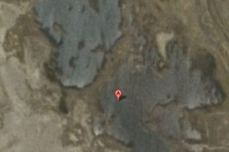
14. Babylon, IraqWhile the surrounding area has excellent visibility, the city of
 Babylon in the pictures blurred. You can bet that it hassomething to do with local rebels ...
สวนลอยบาบิลอน  ประเทศอิรักเป็นของเก่าแก่มาก เป็นสิ่งมหัศจรรย์ของโลกด้วย 
Google Maps 15, 23 beds, which are forbidden to display on Google Maps
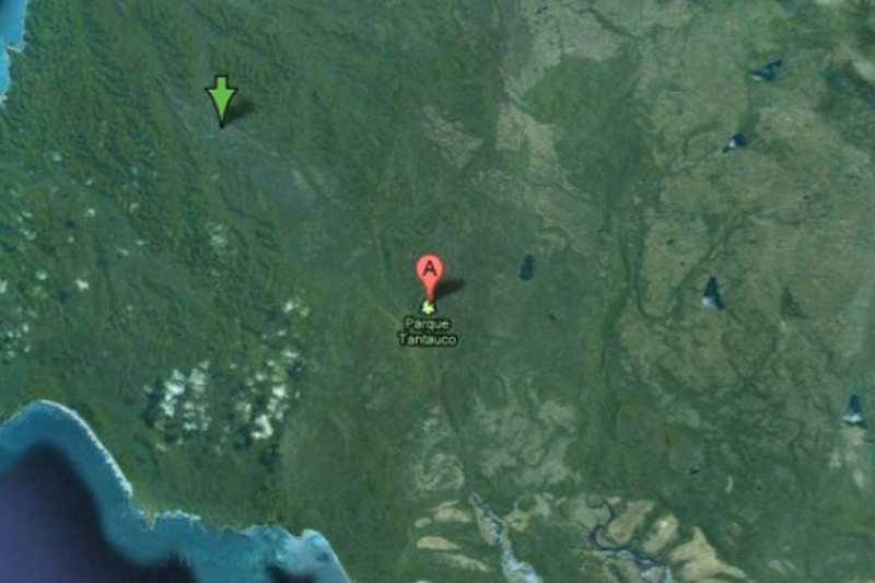
15. Tantauko National Park, ChileFor some reason, this preserve endangered species completely
 excised from Google Maps? No one knows.
อุทยานแห่งชาติ ประเทศชิลีอาจจเป็นว่า มีสัตว์และพืชหายากที่ใกล้สูญพันธ์  ก็เลยปกปิดไม่ให้ใครสอดรู้สอดเห็น
Google Maps 16, 23 beds, which are forbidden to display on Google Maps
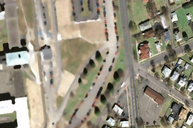
16. "The Hill", a correctional facility in Elmira, USAThis is the highest level of reliability prison in the state of New York. 
Perhaps, after the riots in Attica prison, and several incidents of uprisings and mass escapes around the world, the authorities can really worry about the possibility of escapes by helicopter.
ทัณฑสถาน ขื่อว่า เดอะฮิลล์  สหรัฐอเมริกา
Google Maps 17, 23 beds, which are forbidden to display on Google Maps
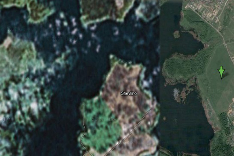
17. House Alexei Miller, RussianAccording to Wikipedia, this place is a "private palace Gazprom
 CEO Alexei Miller." But why is it in preference to all other people? Perhaps we are just not powerful enough to convince Google to cut our homes with satellite imagery.
สถานที่ส่วนบุคคล เป็นผู้บริหารระดับสูงของบริษัทยักษ์ใหญ่ ประเทศรัสเซีย
Google Maps 18, 23 beds, which are forbidden to display on Google Maps
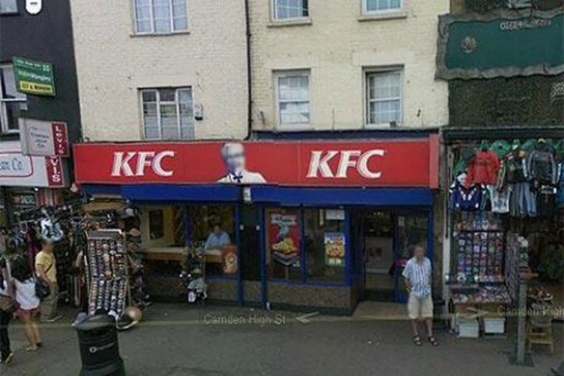
18. Colonel Sanders
This is the strange fact from Google: Colonel Sanders, the person network Kentucky Fried Chicken, does not appear in a single shot from Google Street View. This is because, according to representatives of Google, which Sanders was a real person,
 and the images of real people have to be eroded in any pictures.
พันเอกแซนเดอร์ เจ้าตำนานไก่ KFC  สหรัฐอเมริกา

Google Maps 19, 23 beds, which are forbidden to display on Google Maps
19. Faroe Islands, Denmark
It is believed that in this area there are some unpublicized military installations.
เกาะในประเทศเดนมาร์กคาดว่า เป็นสถานที่ติดตั้งอาวุธลับทางทหาร 

Google Maps 20, 23 beds, which are forbidden to display on Google Maps
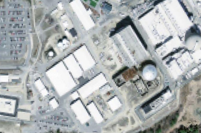
20. The NATO headquarters, Portugal
This shot would have been the most fun, if not had such a sinister context. Whoever edited the picture of Portuguese NATOheadquarters, he simply copied the other part of the earth surface over the image of the building. Very strange.
กองบัญชาการนาโต  ประเทศโปรตุเกส

Google Maps 21, 23 beds, which are forbidden to display on Google Maps
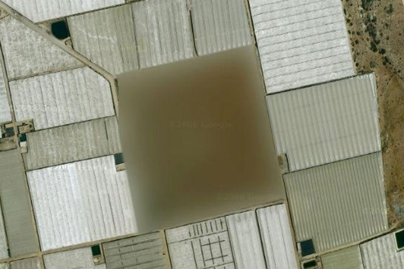
21. Seabrook Nuclear Station, New HampshireIt is believed that in the north-eastern part of the United States
 is a nuclear power plant in Seabrook.
สภานีนิเคลรียร์นิวแฮมเชอร์  สหรัฐอเมริกา

Google Maps 22, 23 beds, which are forbidden to display on Google Maps
22. Missile silo, Spain
According to one researcher, "At this place there is a small structure with something resembling a missile silo in between. What's strange - this zone is not locked in Yahoo! Maps, but its image is not Google Maps ».
ฐานปล่อยขีปนาวุธ  ประเทศสเปน

Google Maps 23, 23 beds, which are forbidden to display on Google Maps
23. Nuclear area, France
We're not quite sure, which means «The Marcoule site of the Commissariat l'Energie Atomique», but we think that the word«atomique» here is the key.
เขตพื้นที่นิวเคลียร์  ประเทศฝรั่งเศส


วันเสาร์ที่ 28 มิถุนายน พ.ศ. 2557

TOUGH ROUTES TO SCHOOLS


Tough Routes to Schools

                                             SOURCE (ที่มา)  :    http://bigpicture.ru 
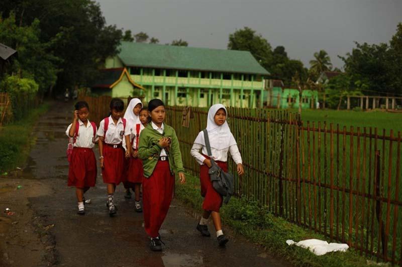
     While Kanchanapisek Suphan students come to school by     chartered vans, in the other areas of this
 planet students go to their schools via tough routes. 
  ขณะที่หมู่เฮา เด็กกาญจนาสุพรรณ เดินทางมาโรงเรียนโดยรถประจำ รถตู้เหมาคัน  ในอีกหลายพื้นที่บนดาวโลกดวงนี้ ยังมีเด็กนักเรียนอีกมากมายที่เดินทางไปโรงเรียนแบบว่า
 ทั้งหินทั้งโหด...

opasnayadorogavshkolu 1 Опасная дорога в школу
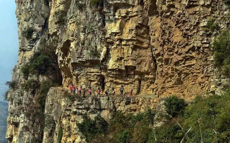
1.  Some of the story may seem incredible, but for
 children of similar regions such road - the usual
 routine on the way to knowledge.  

 บางเรื่องราวดูเหมือนไม่น่าจะเป็นไปได้  แต่สำหรับ
ถนนแห่งการเรียนนั้นมันก็เป็นดังนี้ที่เห็นนี้แล

opasnayadorogavshkolu 2 Опасная дорога в школу
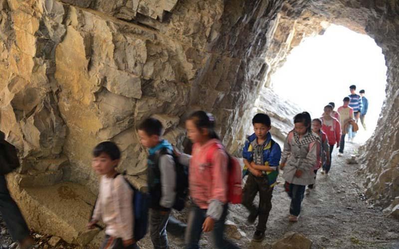
                              2.  You'd be surprised how dangerous the roads some of the children have to go to school. 
พวกเราคงประหลาดใจมากต่อเส้นทางเดินของเด็กนักเรียนจีนเหล่านี้ 
                                                    

opasnayadorogavshkolu 3 Опасная дорога в школу
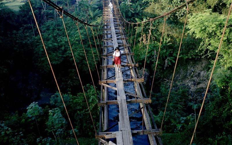
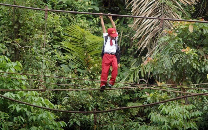
3. For example, in Sumatra, Indonesia, about 20 students
 with a strong will to knowledge must pass on a rope at a
 height of one meter above the river to get to his class in the 
city of Padang.  
(เพื่อนบ้านอาเซียนเรา) ...เกาะสุมาตรา เด็กอินโดนีเซียน
 ในจังหวัดปาดัง  ราว 20 ชีวิต  ต้องไต่สะพานเชือกแบบ

opasnayadorogavshkolu 4 Опасная дорога в школу
4. Incidentally, this is not all - after crossing the river,
 they should still have 11 kilometers through the jungle. 
  Thus the local children go to school for two years, after
 the rains have washed away are here suspension bridge.
ข้ามน้ำไปแล้ว ต้องเดินไปในป่าอีก 11 กม. กว่าจะถึงโรงเรียน 
 เด็กๆ ต้องเดินทางแบบนี้มา 2 ปีแล้ว

opasnayadorogavshkolu 5 Опасная дорога в школу
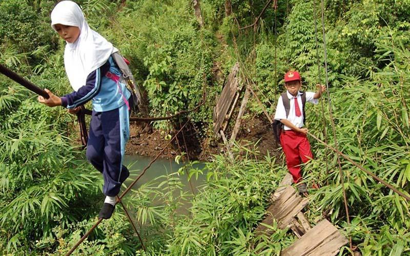
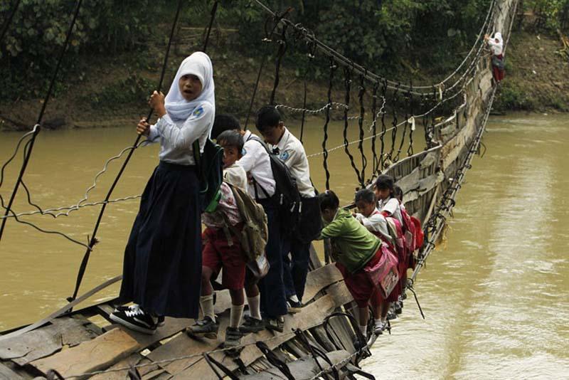
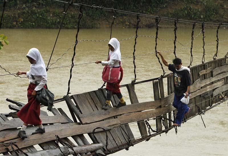
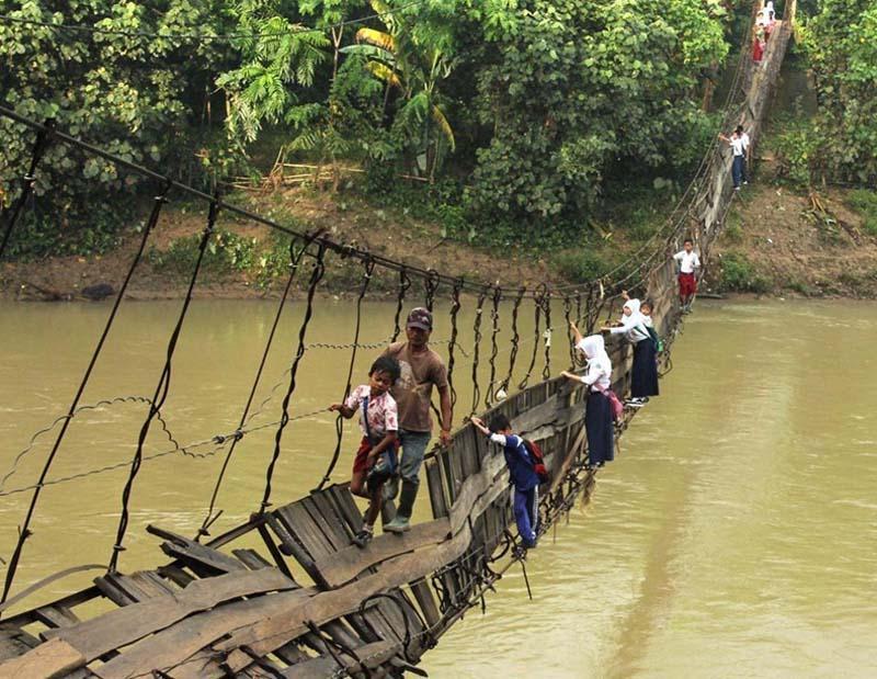
5. Indonesian village Sangiang Tanyung children living 
on the other side of the river Siberang, must cross a 
broken suspension bridge to get to the other side
 where their school.
(ภาพบน) หมู่บ้านซันเจียงตันยุง เด็กนักเรียนที่อยู่อีกฝั่งแม่น้ำ
ซิเบรัง ต้องอาศัยสะพานแบบนี้ ข้ามไปเรียนหนังสือ

opasnayadorogavshkolu 6 Опасная дорога в школу
6. Of course, the other side can go the other way, but then
 the road they will take half an hour more.
 อ้าว... แล้วทางอื่นที่ดีกว่านี้ไม่มีหรือ?  ก็มี...
 แต่มันใช้เวลานานนะสิ อย่างน้อยก็ครึ่งชั่วโมง

opasnayadorogavshkolu 7 Опасная дорога в школу
7. But these kids do not want to be late, so they choose
 a short but dangerous journey.
แต่พวกเด็กๆ ไม่อยากไปสาย... ดังนั้นพวกหนูๆ เหล่านี้แก
ก็เลยต้องเลือกทางไปเรียนที่สั้นกว่า..แต่ว่ามันก็อันตราย 

opasnayadorogavshkolu 8 Опасная дорога в школу
8. But there is good news: the largest steel producer in
 Indonesia - the company «PT Krakatau Steel» decided
 to build a new bridge to replace the old one, which was
 damaged in a flood in January 2012.
แต่ตอนนี้มีข่าวดี บริษัทผู้ผลิตเหล็กกล้ายักษ์ใหญ่
ของอินโดนีเซีย บริษัทพีทีกรากระตั้ว ตัดสินใจจะ
สร้างสะพานใหม่แทนให้แล้ว 

opasnayadorogavshkolu 9 Опасная дорога в школу
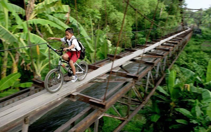
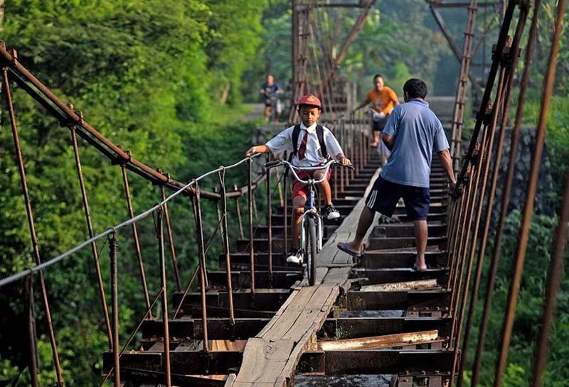
9. In an Indonesian village prespokoynenko children
 ride their bicycles on the aqueduct, which separates
 the village from the town of Suro Plempungan in Java.
นี่เป็นเด็กนักเรียนเล็กในเกาะชวา อินโดนีเซีย

opasnayadorogavshkolu 10 Опасная дорога в школу
10. Children prefer this way, because it is shorter,
 though this aqueduct and is not made for people
 to walk on it.
พวกเด็กชอบเส้นทางนี้ เะราะมันเป็นทางลัด

opasnayadorogavshkolu 11 Опасная дорога в школу
11. And even though it is dangerous, kids prefer it, not
 a workaround, which is longer than 6 km. 
อันตราย...(ก็ใช่ล่ะ.)  หาไม่แล้วพวกเขาต้องใช้ทางที่
อ้อมไกลไปตั้ง 6 กิโลเมตร

opasnayadorogavshkolu 12 Опасная дорога в школу
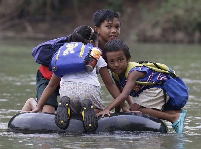
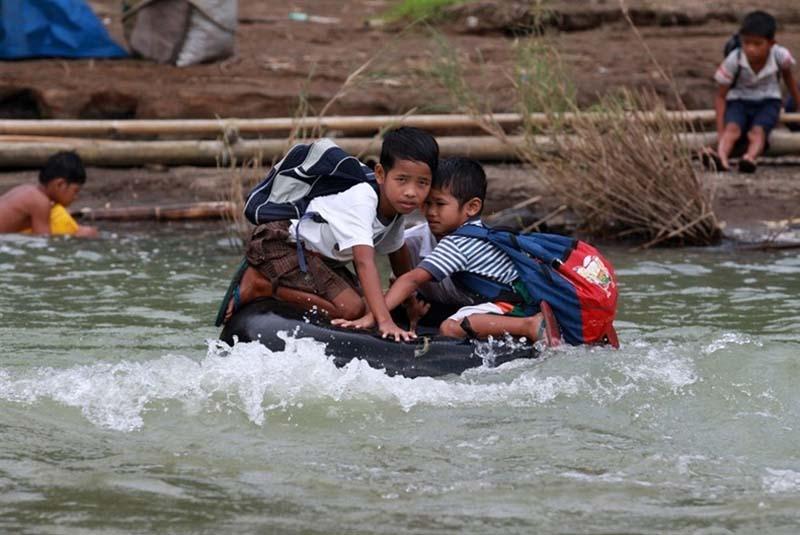
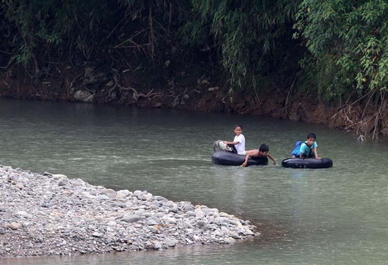
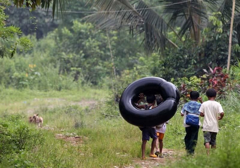
12. In the Philippines, children in the primary schools 
use inflatable tires to cross the river on their way to
 school in a remote village in the province of Rizal, 
east of Manila.
ที่นี้มาดูเด็กประเทศฟิลิปปินส์ (นี่ก็เพื่อนอาเซียนเรา) 
กันบ้าง ต้องอาศัยยางรถยนต์เป็นแพข้ามแม่น้ำ
 ในจังหวัดไรซาล ทางตะวันออกของกรุงมะนิลาเมืองหลวง

opasnayadorogavshkolu 13 Опасная дорога в школу
13. Pupils have to walk at least an hour to get to school
 (and back).
เดินทางนับชั่วโมง กว่าจะไปเรียนหนังสือ 

opasnayadorogavshkolu 14 Опасная дорога в школу
14. But if the river overflows its banks due to heavy
 rains, the students have to miss classes or take 
refuge in the homes of relatives.  
กรณีที่มีฝนตกหนัก ตลิ่งโดนน้ำท่วมโถม 
 เด็กพวกนี้ก็มาเรียนไม่ได้ หรือไม่ก็ต้องไปพักอยู่
บ้านญาติก่อน 

opasnayadorogavshkolu 15 Опасная дорога в школу
15. The local community has filed a petition to the
 government to build a suspension bridge and make
 the transition easier, faster and safer. 
 ชุมชนท้องถิ่นร้องขอทางการให้มาสร้างสะพานแขวนให้
 เพื่อความปลอดภัย 

opasnayadorogavshkolu 16 Опасная дорога в школу
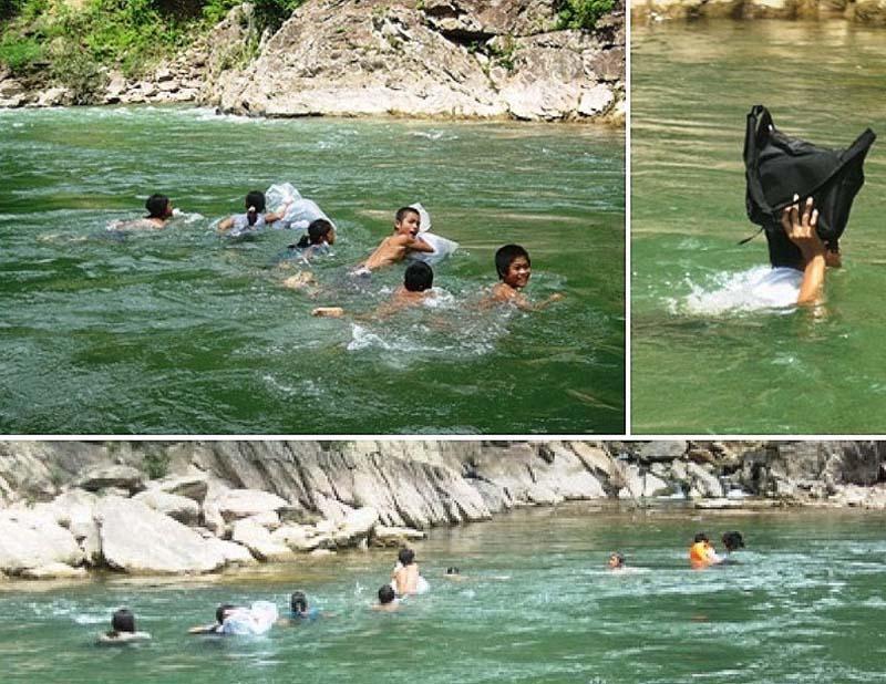
16.  In Filipino children, at least, there is the bus. 
 And these Vietnamese children there and that. 
 Dozens of children from 1 to 5 class swim twice
 a day to get to school and back.  In the town 
Trong Hoa road to school is across the river. 
 And the clothes and books are kept dry, the
 children put them in bags and swim across the
 river almost naked.  On the other side, they get
 clothes and put on her.  This river is 15 meters wide
 and 20 meters deep. 
มาดูเด็กเวียตนาม ในอำเภอตรองฮาว ว่ายข้ามน้ำไปเรียน
 ลำบากจังเน้อ  แม่น้ำกว้าง 15 เมตร ลึก 20 เมตร 
 ต้องว่ายน้ำวันละ 2 ครั้ง  ขาไปและขากลับ

opasnayadorogavshkolu 17 Опасная дорога в школу
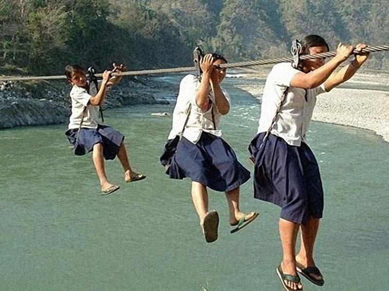
17.  These are the bridges, gondolas quite common
 in Nepal, where almost no good roads.  Children use
 them to get to the other side.  For decades, this lack 
of security led to numerous accidents.  Fortunately,
 several charities are trying to build a safe crossing. 
เด็กหญิงประเทศเนปาล ดินแดนแห่งขุนเขาสูงเสียดฟ้า
 หิมาลัย  ซึ่งจะหาถนนดีๆ ไม่มีแน่ พวกเธอต้องใช้ gondola
 (กระเช้าลอยฟ้า) โหนข้ามไปเรียนหนังสือ

opasnayadorogavshkolu 18 Опасная дорога в школу
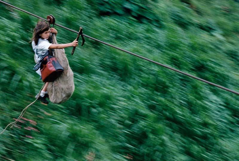
18. In Colombia, the children of several families living 
in the tropical forest, 65 km southeast of Bogota, go
 to school like these ropes connecting the two sides 
of the village.  This is the only way to get to school. 
 Steel cables are 800 meters in length and are suspended
 400 meters above the river Rio Negro.  This girl Daisy
 Mora and her brother Yamid moving at 80 km / h. Yamid
 sits in the bag, because  it is too small (5 years) to cross 
the river on their own. The journey takes 60 seconds.
เด็กประเทศโคลอมเบีย ในทวีปอเมริกาใต้  ดินแดนแห่งขุนเขา
และป่าเขตร้อนอีกเหมือนกัน  ลวดสลิงยาว 800 เมตร 
 และแขวนอยู่กลางแม่น้ำริโอเนโกร 400 เมตร  เด็กหญิงยามิด
 อายุ 5 ขวบ (ในภาพ) ไต่สลิงไปคนเดียว ที่ความเร็ว 80 กิโลเมตรต่อ
ชั่วโมง ใช้เวลา 60 วินาที  

opasnayadorogavshkolu 19 Опасная дорога в школу
19. But back to China ... กลับมาดูเด็กชาวจีนกันอีกครั้ง

opasnayadorogavshkolu 20 Опасная дорога в школу
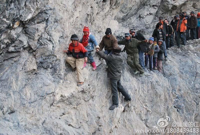
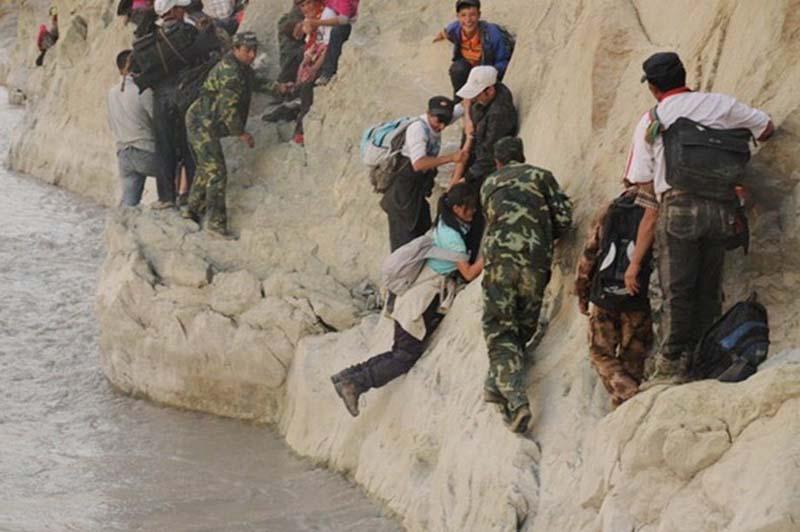
20. These children live in a boarding school in Pili,
 and every day they have to travel on the road dangerous
 cliffs.
เด็กดินแดนชายขอบ ของประเทศจีน
  (ไม่รู้ว่าชื่อจังหวัดหรืออำเภอ ปี๋ลี่ ) เดินทางแบบนี้ทุกวัน

opasnayadorogavshkolu 21 Опасная дорога в школу
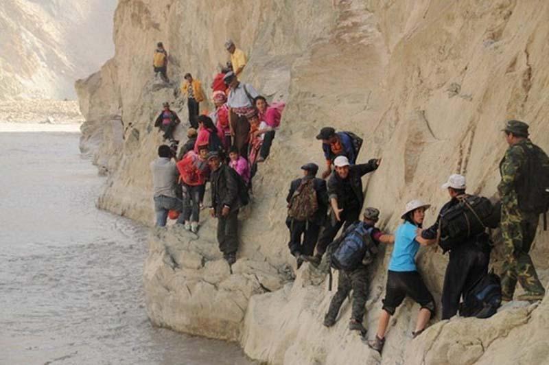
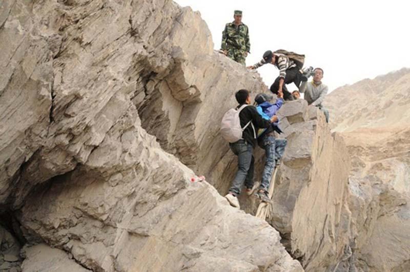
21.  This road is located in the Xinjiang Uygur Autonomous
 Region.  Children have to cross these rocks once a semester.
 เส้นทางนี้อยู่ในเขตปกครองตนเอง ซินเกียงอุยกูร์ 
 (ตะวันตกสุดของประเทศจีน ดินแดนกว้างใหญ่แต่แห้งแล้ง
และมีทะเลทราย  คนส่วนใหญ่มีเชื้อสายมุสลิม) 
พวกเด็กต้องข้ามภูเขาแบบนี้กันภาคเรียนละครั้ง


opasnayadorogavshkolu 22 Опасная дорога в школу
22.  Children also need to wade the cold waters of the
 river, then cross the 200-meter bridge and the four
 narrow bridge.  The journey takes two days!
  น้ำข้างล่างเย็นเฉียบ  ต้องข้ามสะพาน 200 เมตร
 สะพานแคบๆ อีก 4 สะพาน  ใช้เวลาในการเดินทาง 2 วัน

opasnayadorogavshkolu 23 Опасная дорога в школу
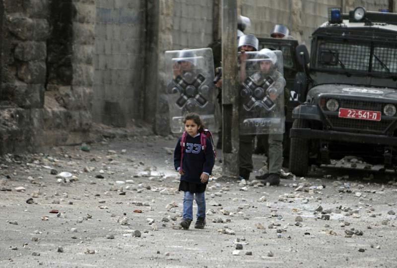
23. And finally, this photo should finally wake up in
 your children a desire to learn!  This girl is obviously
 going to gain knowledge - she goes to school in the
 midst of the conflict between Israeli forces and 
Palestinians in a refugee camp in Shuafat. 
และในที่สุด ภาพนี้น่าจะช่วยปลุกเร้าให้พวกเราอยากไป
โรงเรียนบ้าง   เด็กหญิงในภาพนี้เธอก็อยากได้ความรู้ 
 เธอไปเรียนหนังสือในดินแดนแห่งความขัดแย้ง
 ระหว่างทหารอิสราเอล กับกองกำลังปาเลสไตน์